The site barelybad.com asks:
How many U.S. states have any portion of their borders north of the southernmost part of Canadian land?
In short, “how many states are north of Canada?”, although this is a bit disingenuous as, say, It’s not a trick question, “Canada” is the bit you’re used to seeing on maps. Here’s the answer. Here’s a blog post with a map.
So, then, how many states are south of Mexico? More formally: how many U. S. states have any portion of their borders south of the northernmost part of Mexican land?
This one Is a bit easier, I think.
Obviously you have Hawaii.
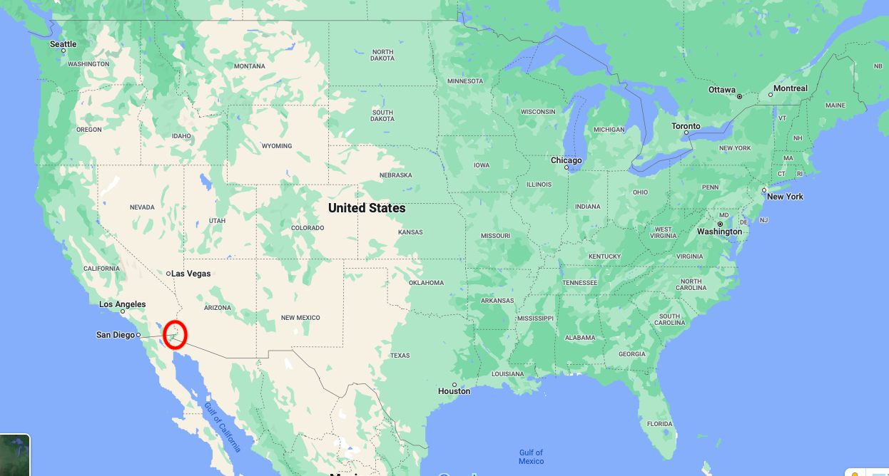
All of the southernmost tier of states are included – California, Arizona, New Mexico, Texas, Louisiana, Mississippi, Alabama, Georgia, Florida. California is the surprising one, I think, but the border doesn’t actually run due east-west in California. The border was defined by the Treaty of Guadalupe Hidalgo (which ended the Mexican-American War) to be a line from the junction of the Colorado and Gila rivers (near Yuma, Arizona) to a point one Spanish league south of the southernmost point of San Diego Bay; that point where the Colorado and Gila meet is the northernmost point of Mexico. This point was hard to find in reality, according to Joel Levanetz of the San Diego Historical Society. The adjacent Mexican town, Los Algodones, Baja California, apparently does a thriving business in dental tourism. Google gives the coordinates of that northeastern corner as 32.71865 N, 114.71972 W.

That the eastern states have land south of this isn’t so obvious. But it happens that I know that Atlanta and Los Angeles are at about the same latitude (34 degrees north) and there’s a lot more Georgia south of Atlanta than there is California south of Los Angeles.
South Carolina and Arkansas are the only really questionable states from eyeballing a map. Below is a screenshot of the Google map of the US… note that Google uses Web Mercator so horizontal lines on the map are actually lines of latitude.
The southern border of Arkansas (with Louisiana) is the 33rd parallel north, so no part of Arkansas is south of any part of Mexico. See for example the Encyclopedia of Arkansas. When the border was established, it was the border between the District of Orleans (present-day Louisiana) and the District of Louisiana (present-day Arkansas).
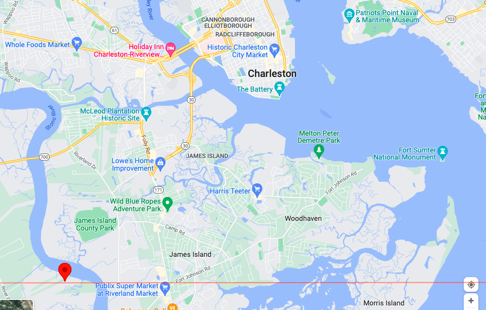
As for South Carolina, a line heading due east through the northernmost point of Mexico passes through it. This line was drawn with the highly advanced technology of “opening the screenshot up in Preview and drawing it, holding down the Shift key to make sure the line was horizontal”:
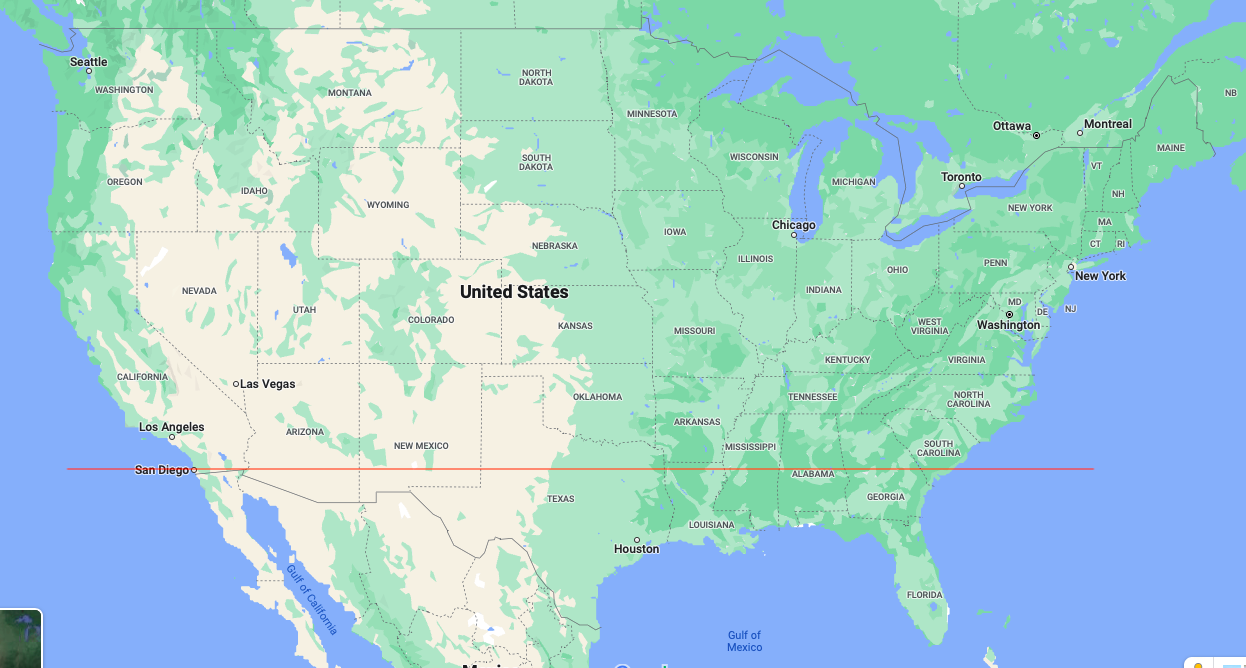
As you can see the area below the line takes in a tiny sliver of California, portions of Arizona, New Mexico, and Texas, nearly all of Louisiana, about half of Mississippi, Alabama, and Georgia, all of Florida, and a small bit of South Carolina. The line passes just south of Charleston:
This is also a quiz on Sporcle that I played once, in 2017. I got 10 out of 11; I don’t know which one I missed.
A hat tip is due to this Reddit post which got me thinking about this.
